Collaboration in the heart of Eurasia
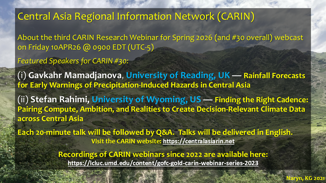
Register for the >>10APR26<< webinar here: https://msu.zoom.us/webinar/register/WN_6oYknXAAS8mG7nPu7n76tA
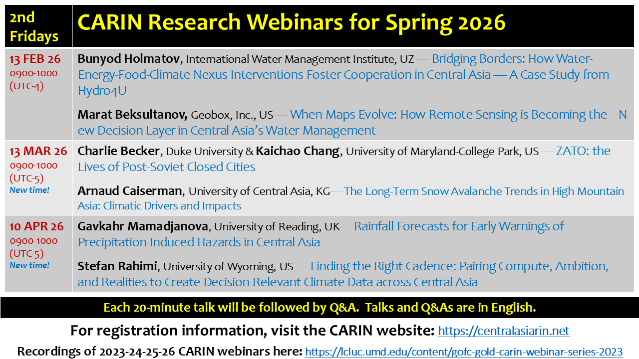
Recordings of the FEB & MAR 2026 CARIN Research Webinars now available!
FIND RECORDINGS OF PAST CARIN WEBINARS HERE:
https://lcluc.umd.edu/content/gofc-gold-carin-webinar-series-2023
https://lcluc.umd.edu/content/gofc-gold-carin-webinar-series-2021-22

Opportunities
Collaborations, funding, and fellowships

Our Network
CARIN is a platform to promote and support collaboration among remote sensing experts, researchers, academicians, NGOs, and relevant government agencies in Central Asia.
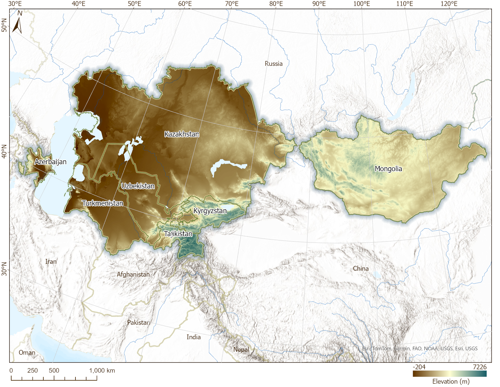
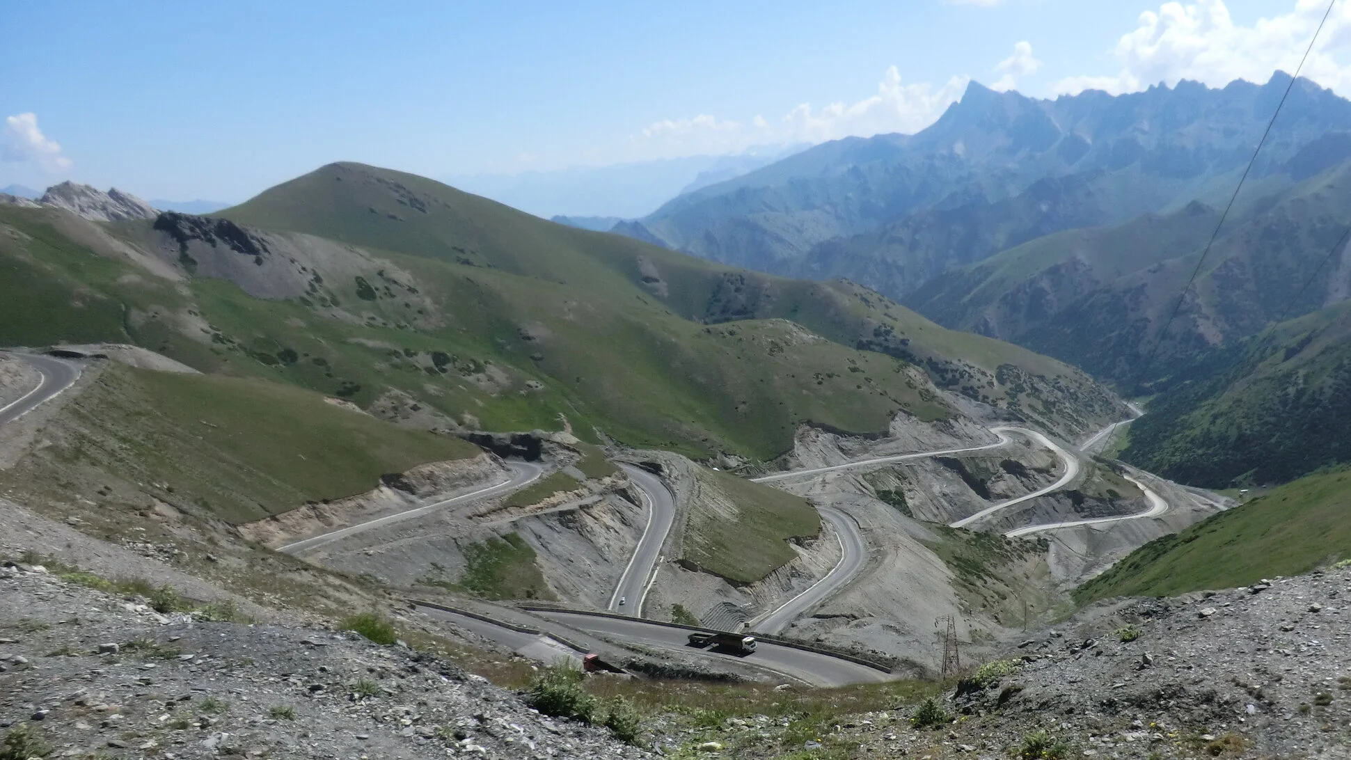
Where we work…

Remote sensing reveals the drylands of Central Asia using a long time series of MODIS surface reflectance data (from MCD43C4) processed using the “tasseled cap transform” to produce three factors displayed in this false color composite: “greenness” shown here in green is associated with vegetation; “brightness” shown in red is associated with the amount of exposed soil; and “wetness” shown in blue draws our attention to high-elevation snowy areas. Areas in flat black displayed open water. Very dark areas (thus low values in brightness, greenness, and wetness) are associated with very arid deserts.

Publications & Information Resources
Publications, reports, and research relevant to Central Asia